The Legend of Queneesh
Long ago there were big cedar-planked houses, totem poles and canoes in the Comox Valley. The nights were very quiet, except for the sounds of the water, sea birds and the hooting of owls. One night an old man, Quoi Qwa Lak, had a dream. In that dream, a voice told him that he must tell the chief and the K’omoks people to prepare for a great flood.
They built canoes and packed them full of food and clothes. The young men made a strong cedar rope and took it to the top of the glacier and fastened it tightly.
The people tied their canoes to the rope, not too long after it began to rain. It rained and rained for days. Soon there was only a little of the glacier showing. The K’omoks people were afraid. Then all of a sudden the glacier began to move.
The people began to cry ‘White Whale, White Whale! Queneesh, Quenessh’. The glacier had taken the form of a whale and saved the people. The rain stopped, and Queneesh still stands guard over the K’omoks people to this very day.”
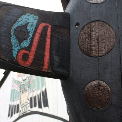
From a sign outside the I-Hos Gallery in Comox, BC, Canada.
Indigenous groups have occupied the Comox area for thousands of years — many are from Salish origins with the two predominant groups being the K’omoks and Pentlatch tribes. By the time European made contact in 1792, the area had been fought over (many times) and had already earned the Land of Plenty moniker in oral history.
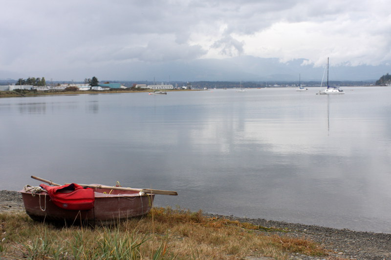
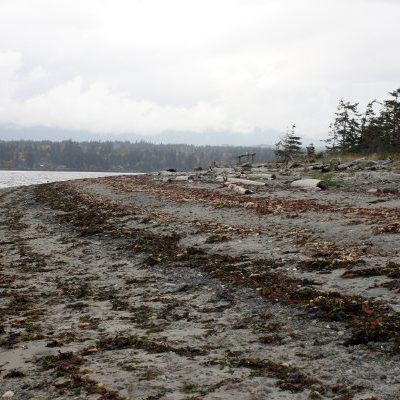
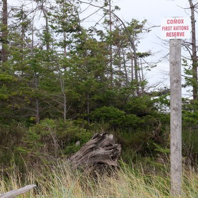
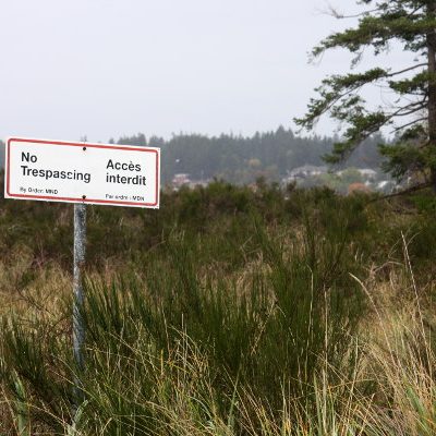
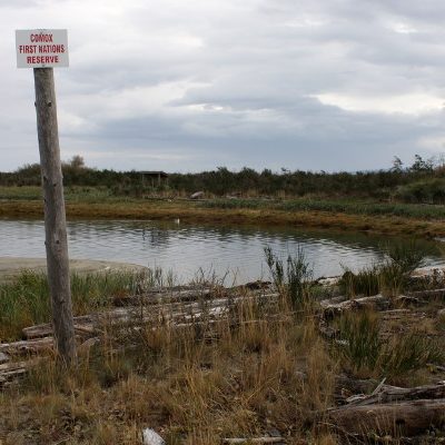
There are currently three K’omoks reserves in the Comox area: the uninhabited Puntlache / Pentledge Reserve (Courtenay), the Comox Indian Reserve #1 (where the I-Hos Gallery is located), and the Graveyard Indian Reserve #3 (also known as the Goose Spit Reserve), which I’ve written about in the past. The later is the one that we wandered around the edges of during a recent trip to Comox.
Like mentioned before, a “spit” is a giant permanent sandbar that juts out into the ocean; and, Goose Spit Regional Park in Comox is composed of three sections: Balmoral Beach, the H.M.C.S. Quadra, and the Graveyard Indian Reserve #3 on the tip. The modern history of this strip of land is contentious and starts when the spit was commandeered for the Royal Navy in 1896 and split up into these three sections.
The reserve embodies 14 acres of sandy, scrubby, windswept land that contains the remains of generations of aboriginals (traditionally chiefs). The K’omoks band has for years sought compensation for the destruction of burial sites, which is thought to have occurred in the hundred-plus years of military occupation after 1896.
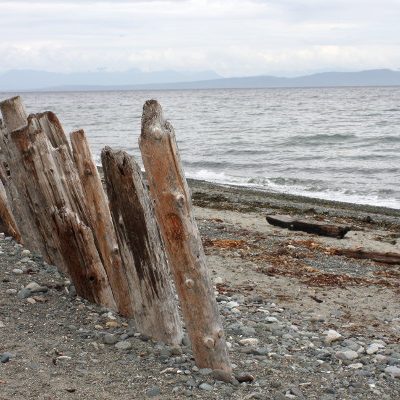
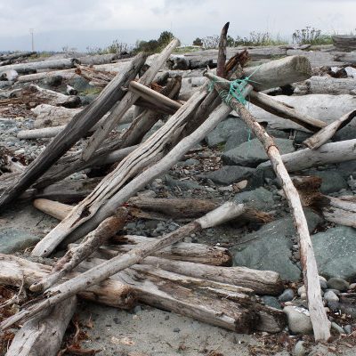
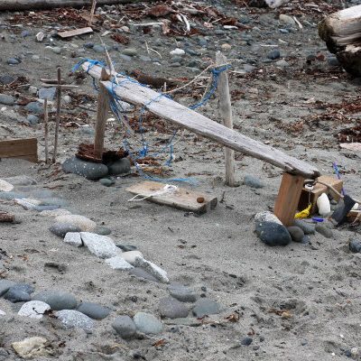
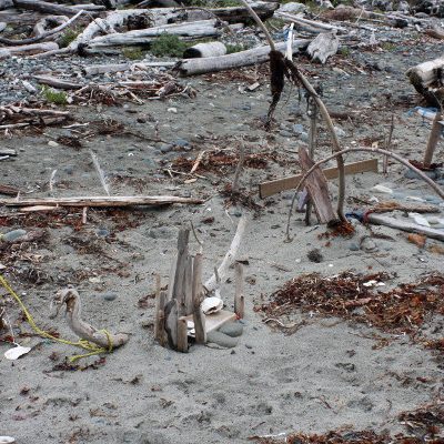
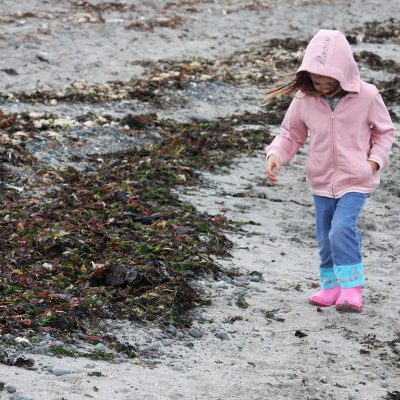
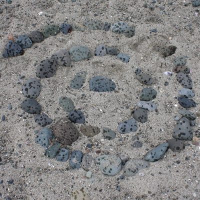
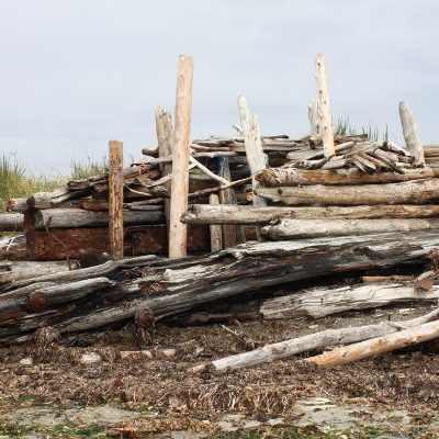
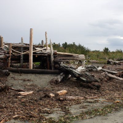
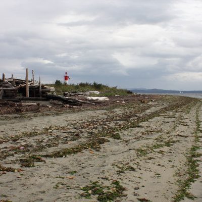
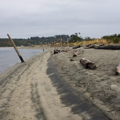
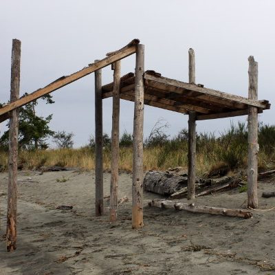
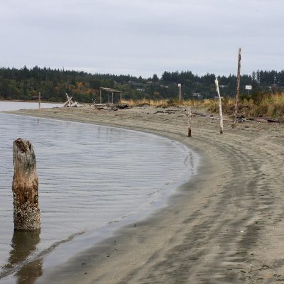
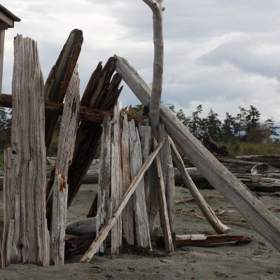
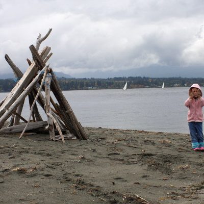
The hike out to the tip of the spit takes a fair while when you’re walking with a three-year-old intent on examining every jellyfish, shell, rock, piece of driftwood, and leaf on the beach (it take around an hour one way). It’s completely worth the hike and is an experience full of unique sculptures and structures.
For most of the walk, we fought the cold wind, rain, seaweed and difficult terrain. At each stage, I thought about turning back but persevered, for which I’m glad because as we rounded the tip of the reserve part of the spit we encountered and quiet, peaceful sandy area that was sheltered from the wind, had warm calm water, and lots of interesting things to explore. The strip also had an unusual calm about it that seemed to radiate from every nook, structure and grain of sand; I thought for sure at one point that we’d been transported to a quiet tropical beach.
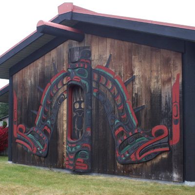
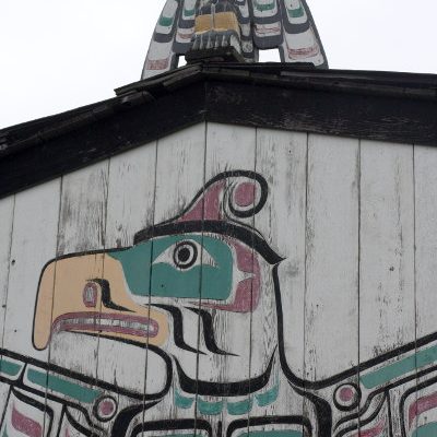
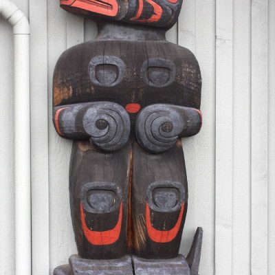
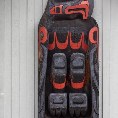
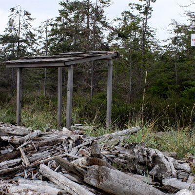
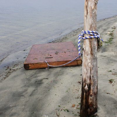
The pole structures around the reserve drew my interest. In the archaeological community Comox is known for the wooden stake fish trap structures peppered throughout the Comox Harbour. The above structures are most likely not related to these fish traps — but were a constant reminder of the intricacies of Indigenous American marine culture.
1 comment on “K’omoks”Add yours →
Comments are closed. You can not add new comments.